We had over 4 inches of rain in 24 hours here. Today we are approaching 1-1/2 inch and it is only 10:10AM! No matter how much Ohioans complain about our weather, my heart goes out to those in the midwest whose homes and farms have been underwater for months. I cannot imagine the destruction. Pray for them! Makes it hard to write about Las Vegas and the Hoover Dam, but here I go.
We spent one more night in Las Vegas and took off the next morning for Hoover Dam which neither of us had ever seen. Of course, you may remember the point of this trip was to go to places we had missed in our previous travels among the 49 States. (#50 will be for our 50th wedding anniversary!)
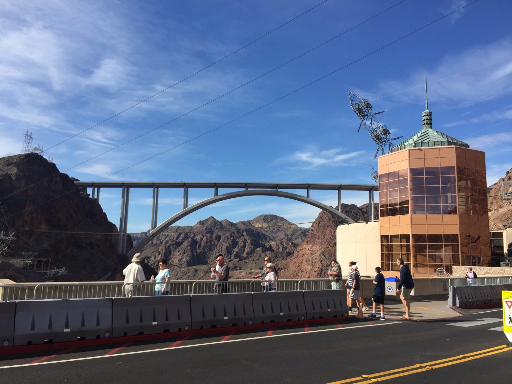
Another gorgeous cloudless day in Nevada as we entered the Hoover Dam area. We were told we might not be allowed to drive across, yet that particular day we could walk across and the drive across the road that tops the dam.
Gorgeous artwork all around!
Look at weird slant to the tower holding power lines!
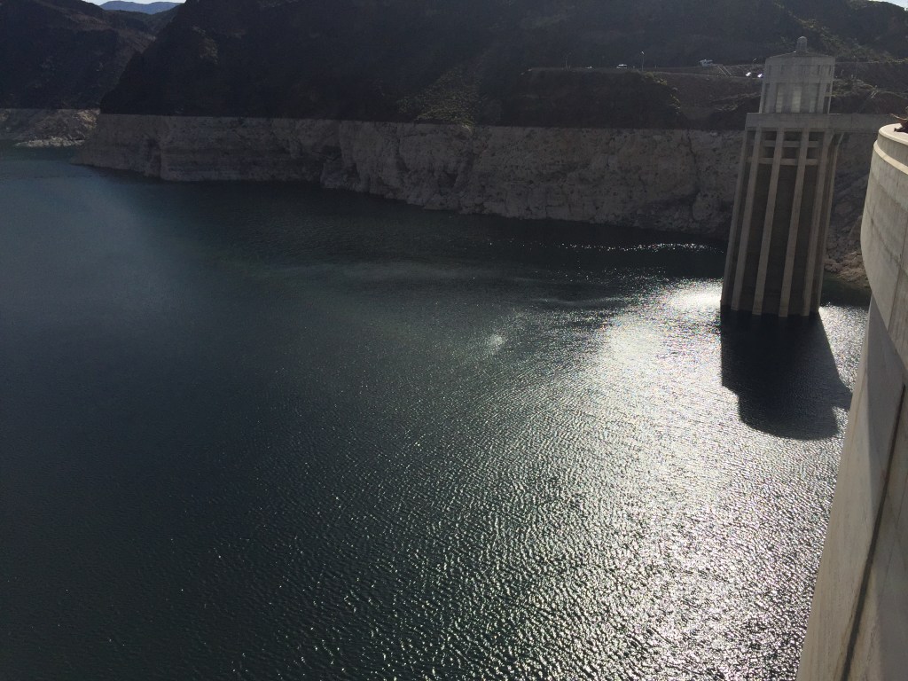
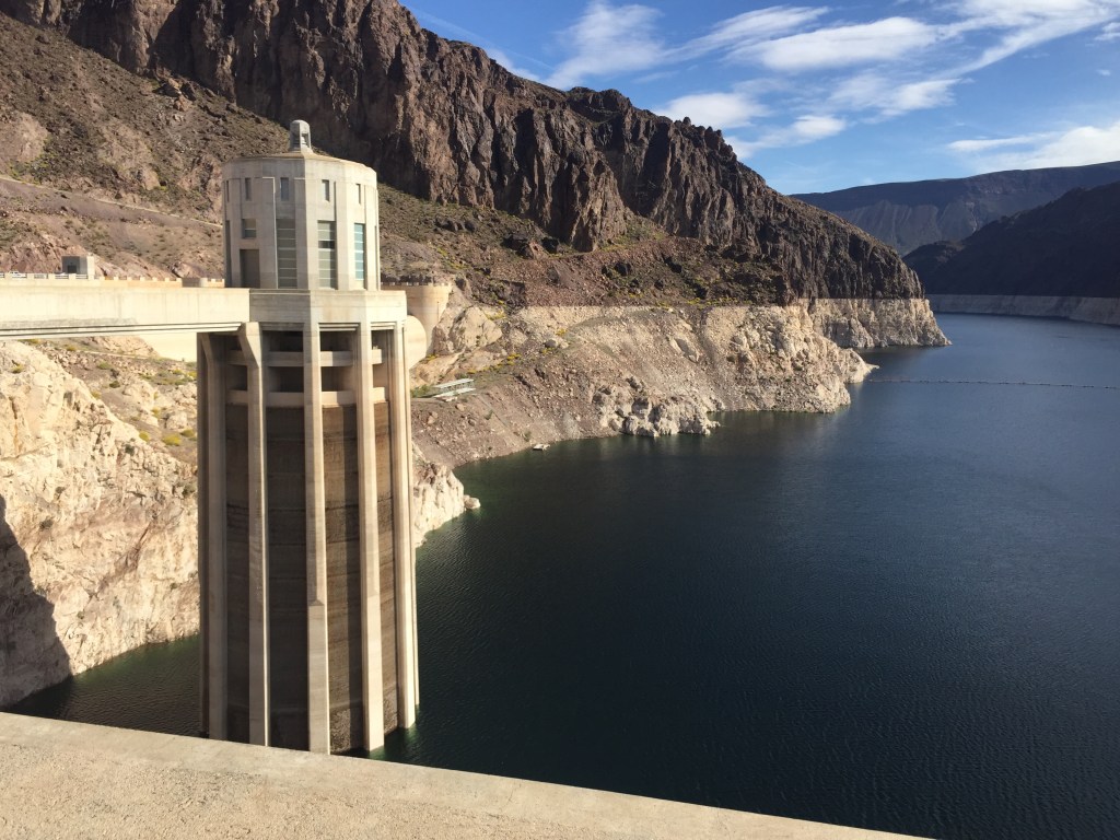
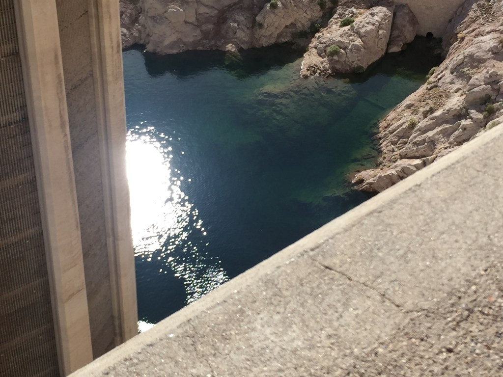
The lean on the towers fascinated me. As did the sparkling sun on the water. Look for the color line along the cliff that shows how high the water has been in the past. Wish we could drain the Midwest and send it to Hoover Dam!!
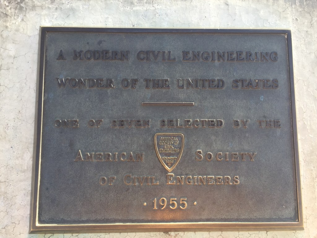
I liked this plaque!
I was all of five years old then!
So had to wonder the depth along the shore! According to http://mead.uslakes.info/level.asp The water level on June 18, 2019 was 1,085.46 feet. The level is 143.45 feet below full pool of 1,229.00. I love looking in water depths!
This is the view you are likely familiar with. Yep, it made me a bit dizzy!
Look at the employee parking!! Both sides of the water. Greenish water is expelled water from power plant.
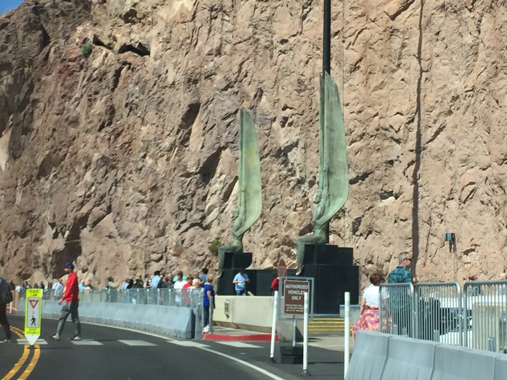
And finally the huge angels. You can likely see better photos on bing images, but these are mine.
On the way, near Nellis Air Force Base, we saw the largest drone we had ever witnessed with our own eyes. Quite intimidating! Nothing the guys below ever experienced for certain!
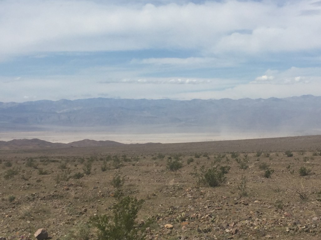
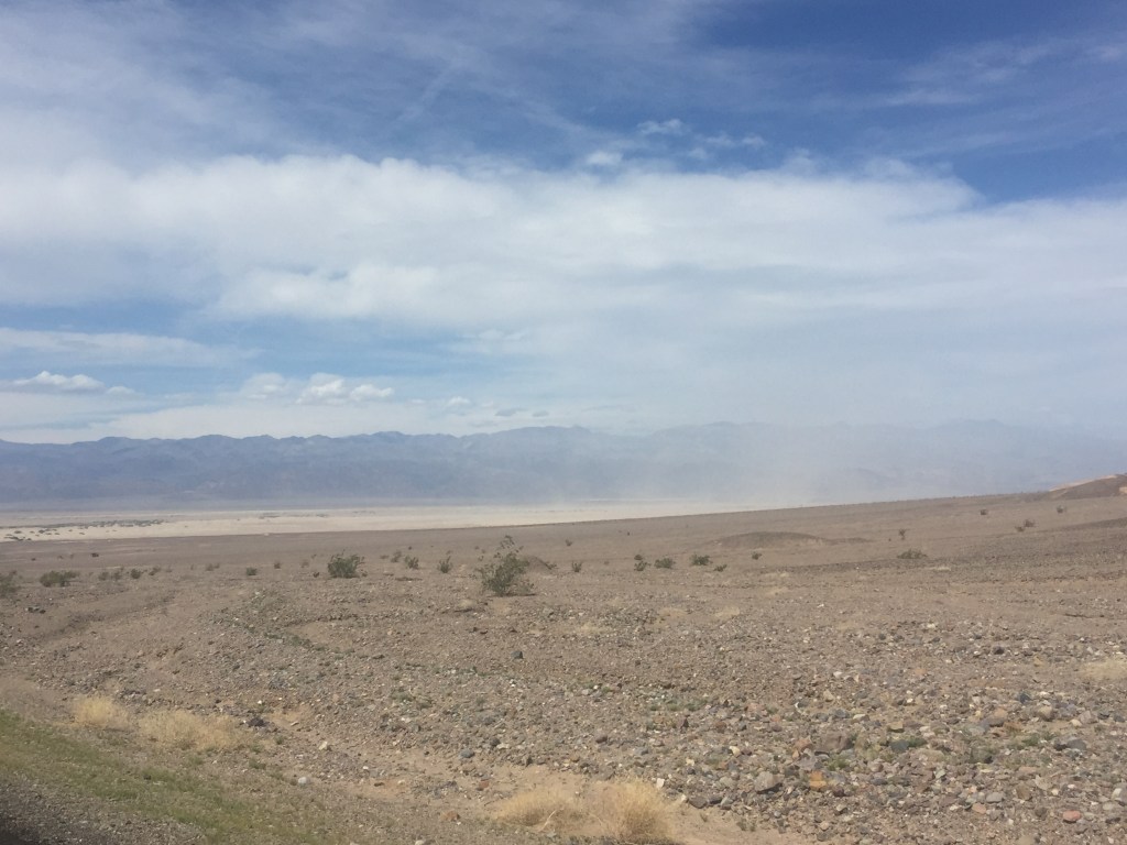
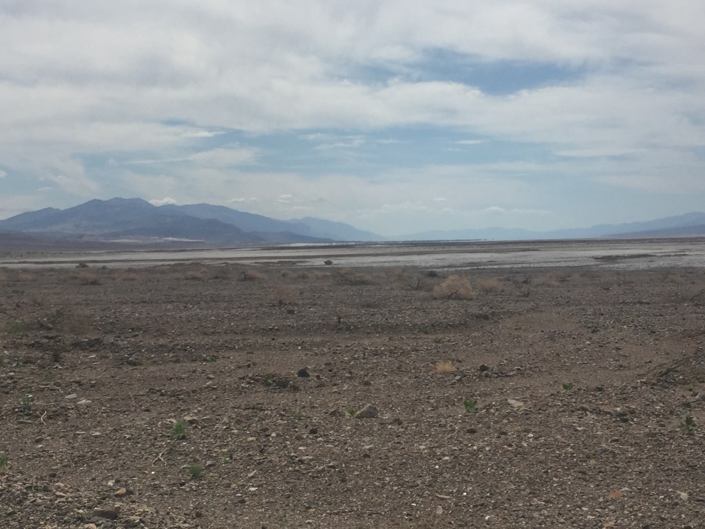
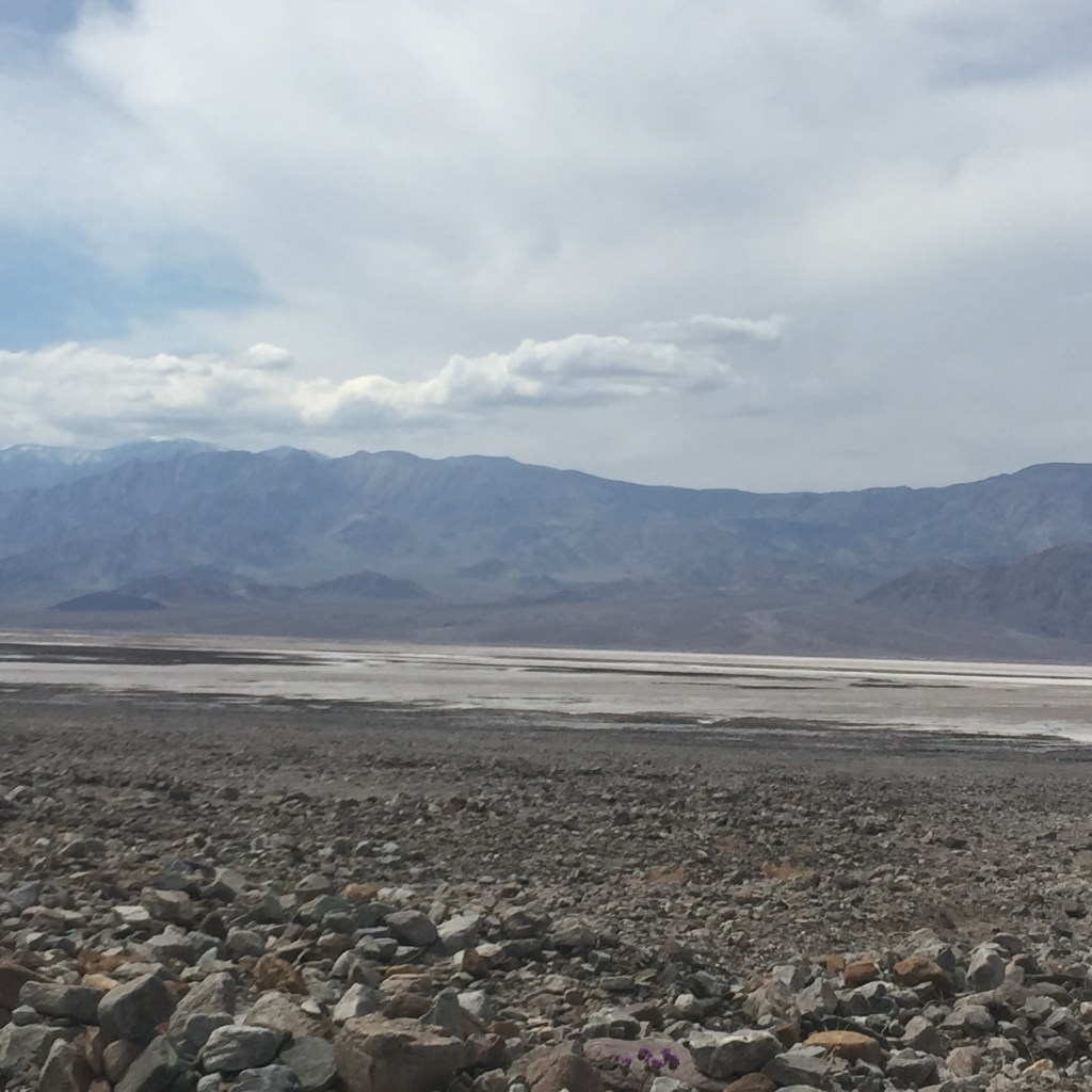
Yes that tv show is where my thoughts about Death Valley were formed! How about yours? We were privileged to get to see the Valley with our own eyes. Granted it was a somewhat windy day, (never good in a sandy environment) but we were amazed at the contrasts. I was hoping to see the lake someone had told me formed recently from the torrential rains they had experienced. But it was all evaporated by the time we visited there.
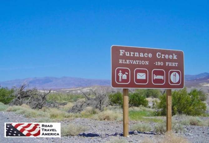
We entered at Route 374 near Beatty, Nevada about 3307 ft elevation. The park is over 3,336,000 acres. We saw a tiny portion. Daylight pass was 4316 ft elevation. The basin of Death Valley lies at it’s deepest point 282 ft BELOW sea level. We went to -190 ft that day.
Sand, desolate environment. I cannot imagine being relocated to this area by the military from the Midwest or one of the coastal areas!
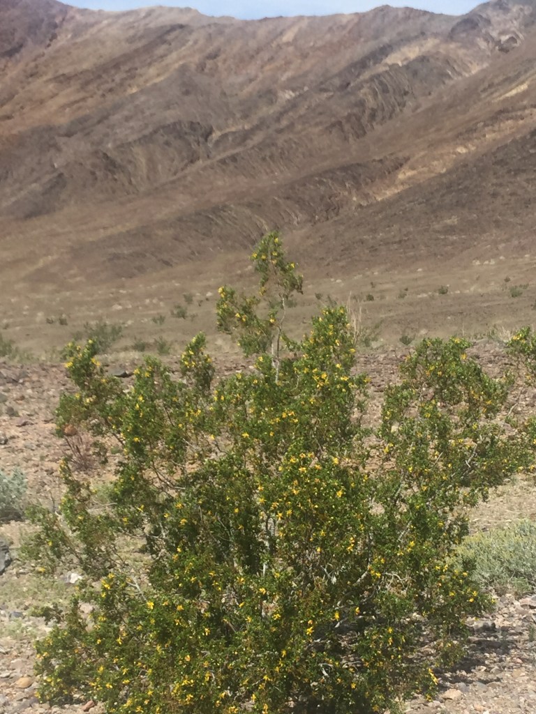
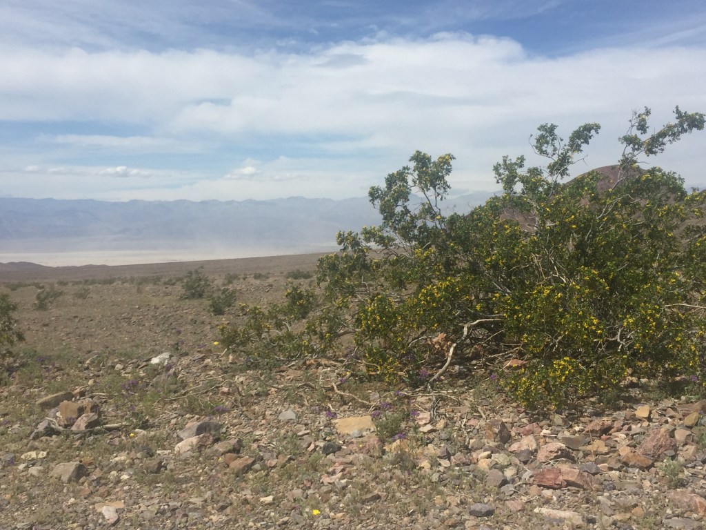
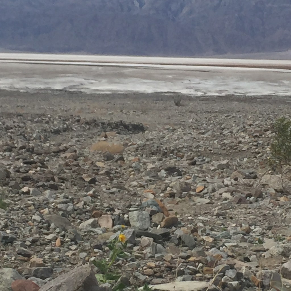
Yes, Honey, They have flowers there!
We thought we could taste the borax?
See, I told you there were flowers!
Breeze in the distance.
Reminded me of a sandy beach area, only drier!
In a word, barren!
In one of my favorite stories, Hinds Feet on High Places, Much Afraid meets little flower called Acceptance-with-Joy.We thought we met that flower years ago when we first visited the Grand Canyon. She seemed to be here, too!
Bob and I both thought of the story when we saw this tiny yellow flower struggling in the harsh conditions.
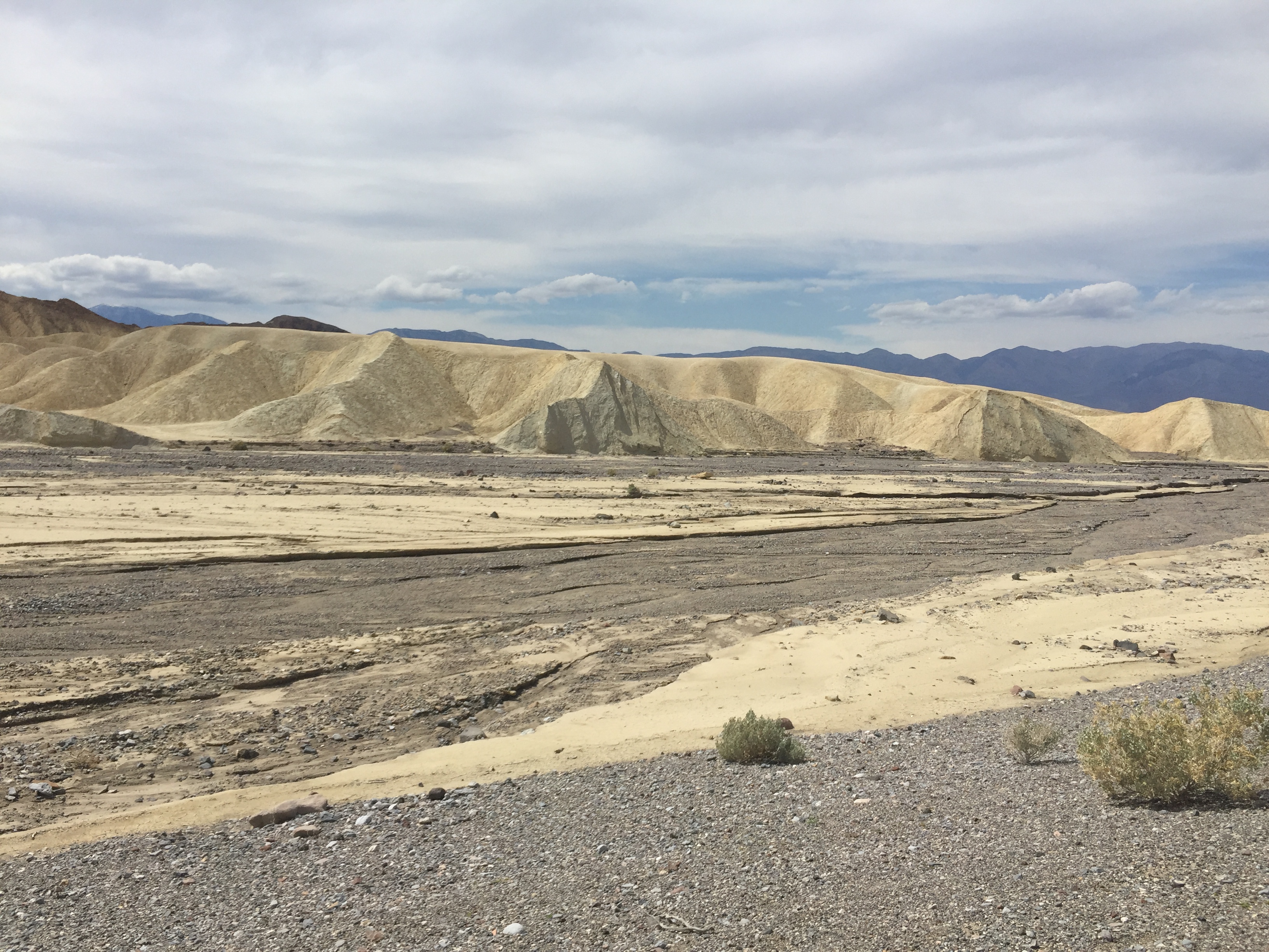
Park reminder of Borax mining years ago.
An amazing place to see. So glad I do not have to live there or cross it in a covered wagon!
Las Vegas. Oy. I do not have much good to say about the downtown gambling areas. We went during the week for cheaper room rates. Used it as our base location to visit both the Humboldt-Toiyabe National Forest area and Death Valley.
We stayed at the Grand Hotel in “Old Vegas.” Bob took his quarters hoping to use them up with the slot machines. Disappointed that the machines all take paper money now and issue a paper voucher for your winnings. No rattling coins when there was a winner, but plenty of lights and noise! We were easy walking distance to the Fremont Avenue canopy that formed a pedestrian-only gambling mall. At night we saw zip line riders overhead, so many flashing neon lights coordinated with music for six minutes on the hour. Too many weird people. Women in scanty clothes and men too aroused for public display (in my opinion). We were amazed that tourists were there with their children. I never would have exposed my daugher to such behavior as a child or even as a teenager! Yes, I am old and fond of my values.
The “Strip” with the mega-hotels was also not to our liking. Bob was driving and the traffic was awful. Then a truck with a huge advertisement made with led lights pulled in front of us. It literally hurt our eyes. The sidewalks were crammed as bad or worse as the Avenues in New York. People shoulder to shoulder with shopping bags and jaws agape. We did not go into any of the huge hotels as parking was at a premium and we decided we were just not THAT interested.
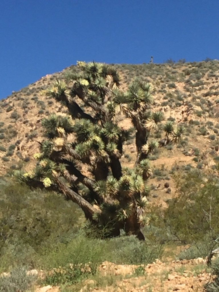
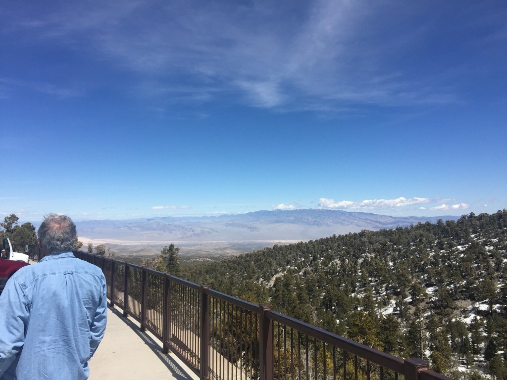
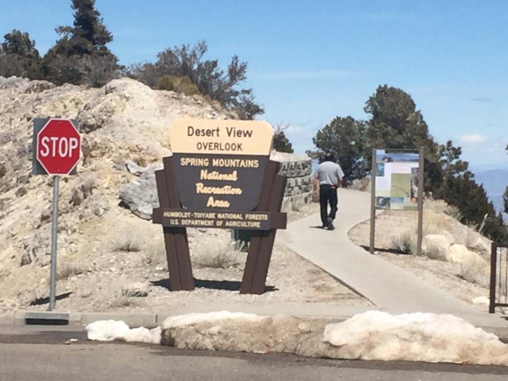
The drive to the west of Las Vegas was so interesting. We were looking for Red Rock Canyon and did not manage to find it. But we found the scenic road into the National Forest and Charleston Peak Ski area. The cactus were blooming and very fragrant.
Notice one on the hilltop, too!
We noticed the cactus stopped growing at about 7000 feet in elevation, at least in this area. We drove to an elevation of 8,437 feet.
There seem to be increased readers on weekends, so likely I will begin planning my posts for the weekend, or Thursday through Monday or who knows where my mind goes? Oh, the lyrics were actually “Who knows where the time goes?”
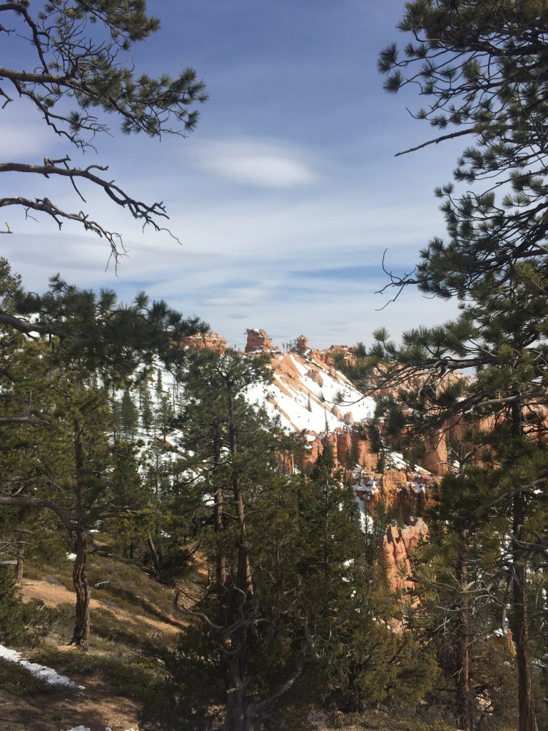
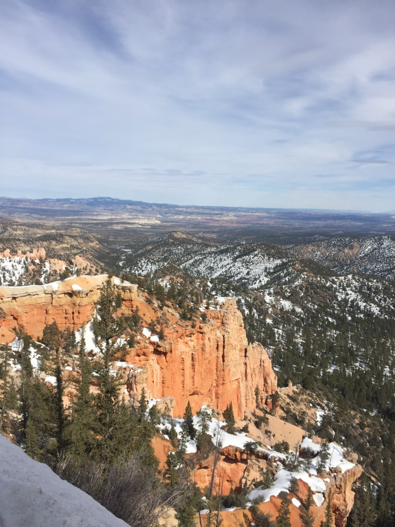
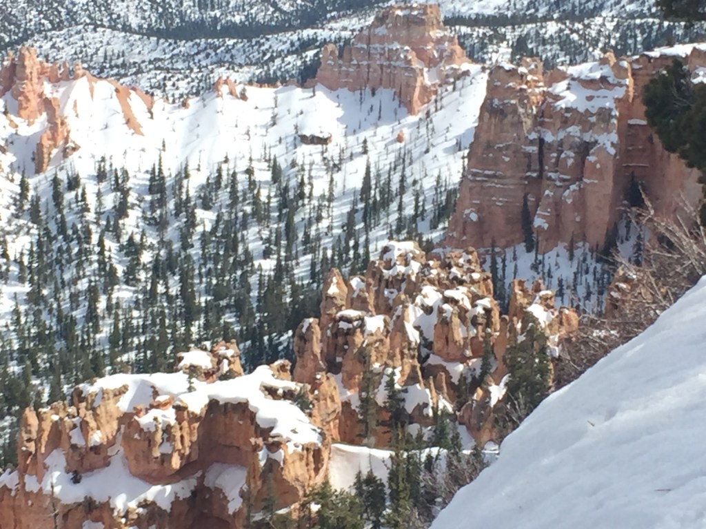
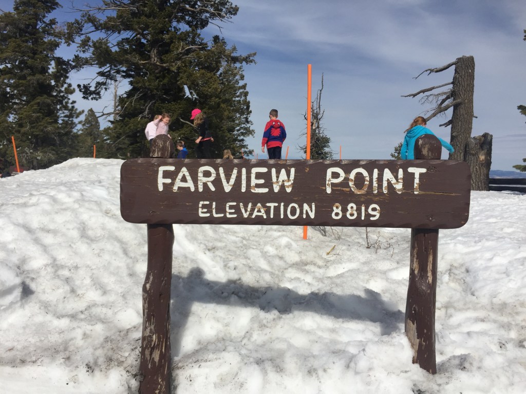
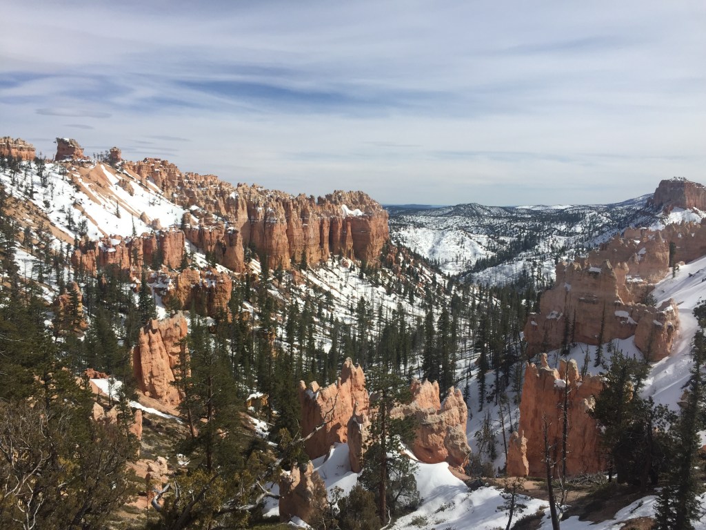
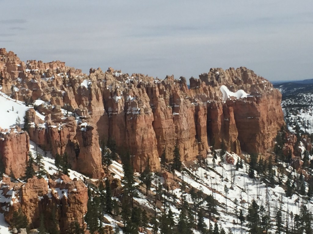
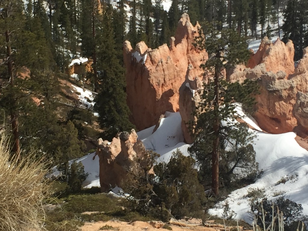
Looking back through my collected vacation literature I was delighted to see the National Park Service called Bryce Canyon “Poetry in Stone.” No, I did not write poetry about it, just tried to capture the grandeur in photos!
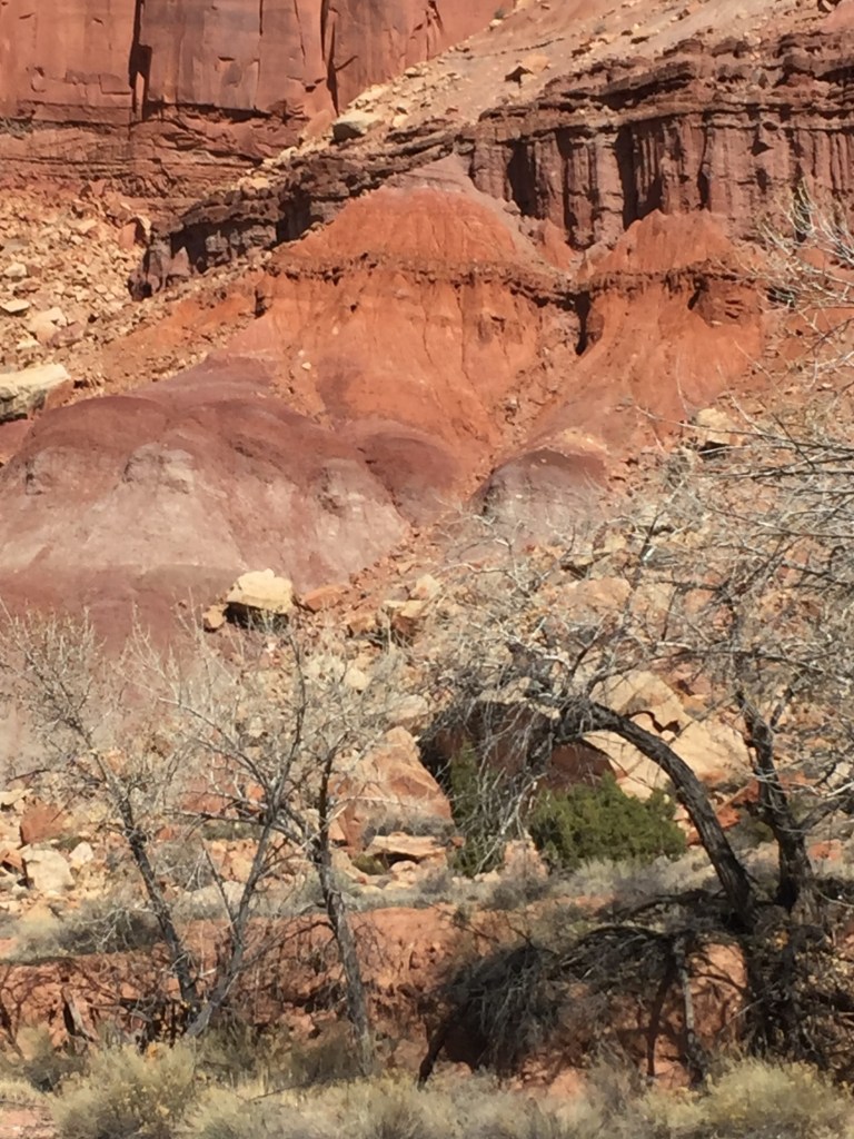
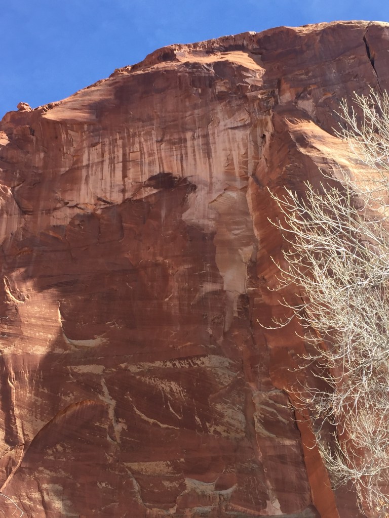
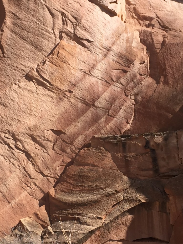
From Bryce we did make it that night to our motel in Cedar City. I want to back track to Capitol Reef, where we so enjoyed the scenic drive through the many geological features. One thing I did not emphasis was the black rocks.
The Park Service describes these as coming from 20 to 25 million year old lava flows. “Pieces of lava rock were transported many miles from their source, and were smoothed and rounded by their violent journeys within gritty floodwaters. When floods receded, black boulders were left scattered across the floodplains. The black boulders are black on the inside too! The white coating on the surface of many of the boulders is a mineral crust known as caliche, which is mainly a thin film of calcite and gypsum crystals. Caliche forms when mineral-laden groundwater seeps upward, coats the underside of the boulders, and evaporates from the surface, leaving its dissolved minerals behind.” I found the white frosting on the rocks as interesting as the rocks themselves.
I just find this stuff so interesting! Reading National Park literature I can learn a bunch without having to study geology to discover the facts. Nice they teach me as they publish!
I kept thinking of my baseball friend, Levi, and wanting to pick up the baseball sized black rocks. But alas, I am too honest, and could not do it. Besides the Park Service asked us to “not disturb or collect rocks or other park resources.”
I did pick up a smaller black rock along the side of the road after we left the park. Alas, neither one of us took a photo of the large black boulders 😦 So you will have to imagine!
Yep, by far my favorite. Would love to go back some day and stay in a lodge or nearby accommodations!
Look for the animal tracks in the snow!
Goats? Mountain cats? Bear? I will never know but I delighted to see the tracks 😉
When we traveled in Alaska in early spring we learned that willows are one of the things that bud out first. Well, that makes sense as that is true at home in Ohio, too. See the willow buds in this vista foreground?
A rugged place to grow. Did it burn?
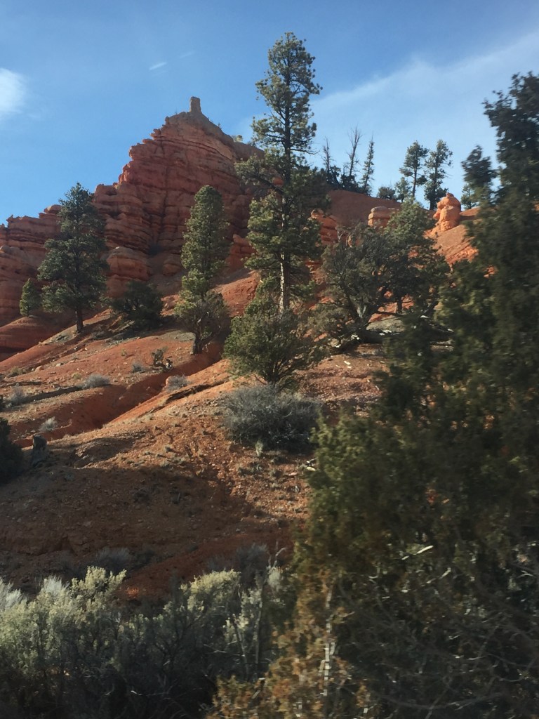
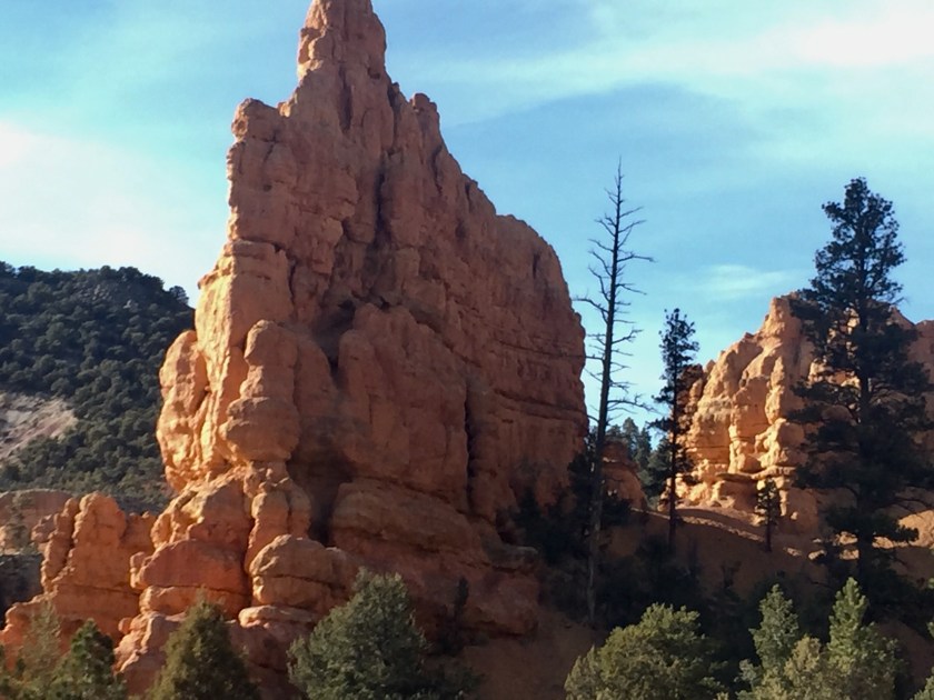
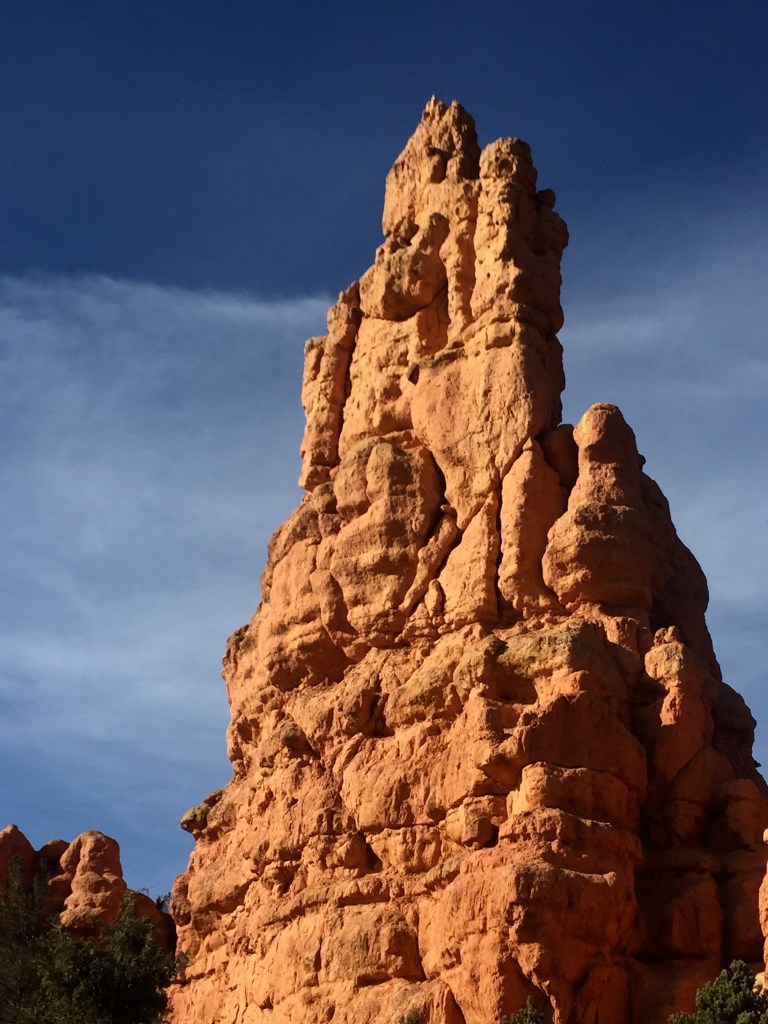
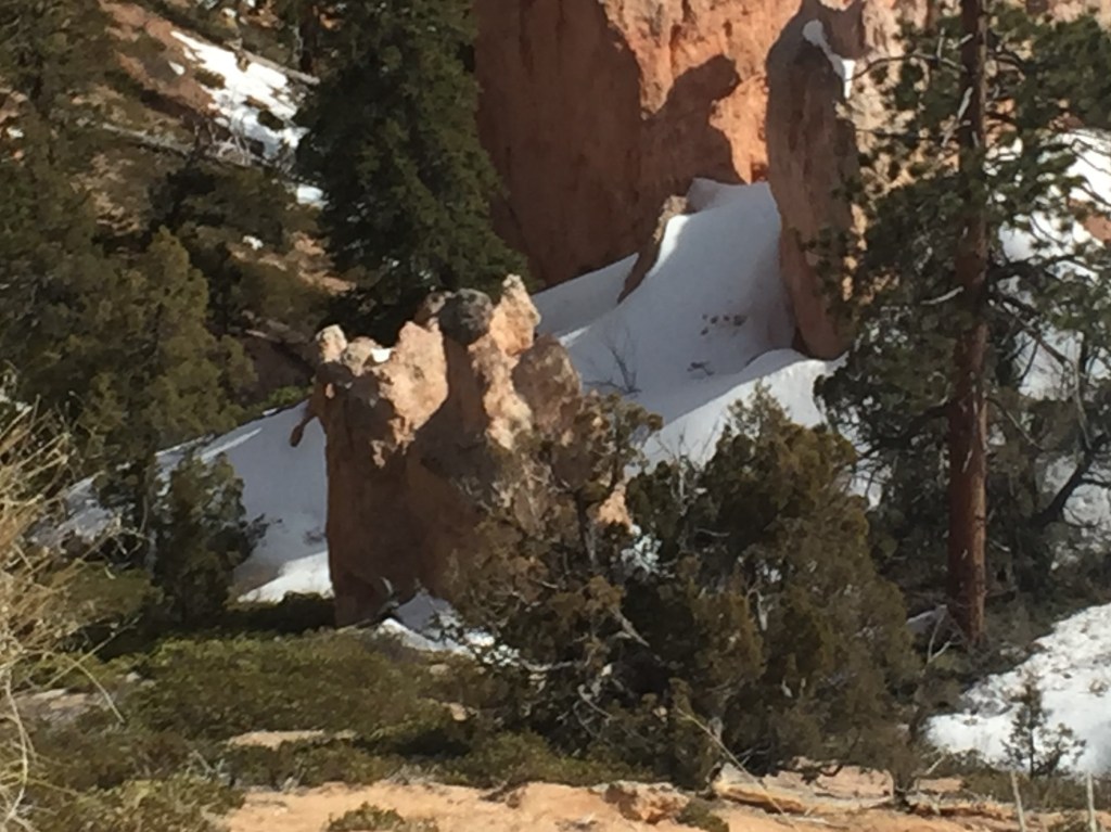
Bob loved the spires
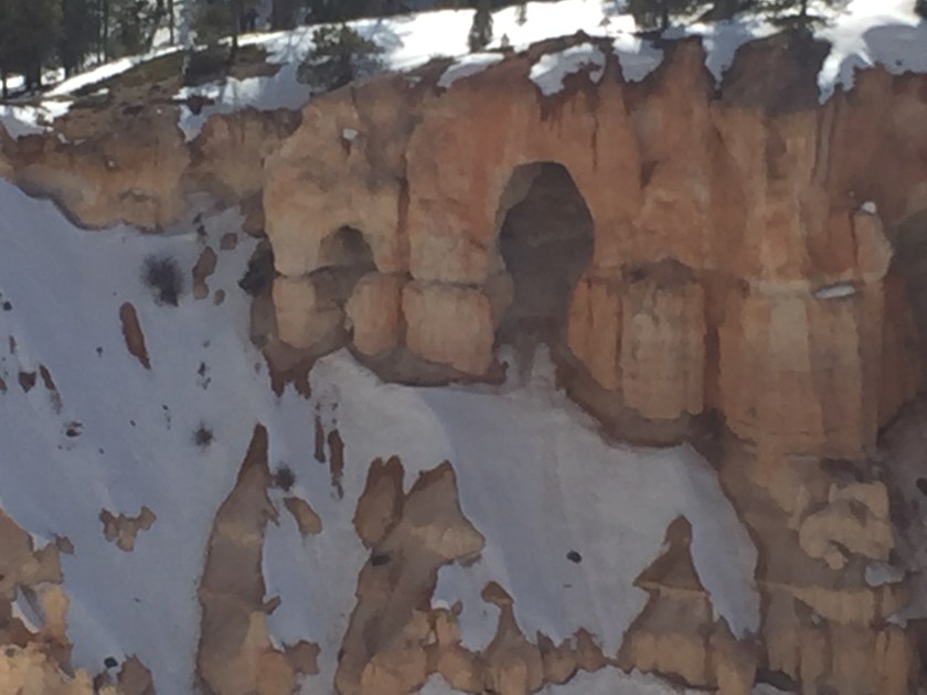
Who lives in there? Goblins? Mountain folk?
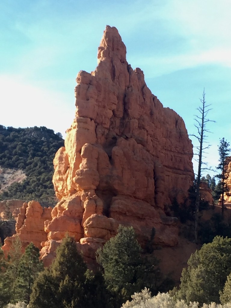
Cave like formation from distance.
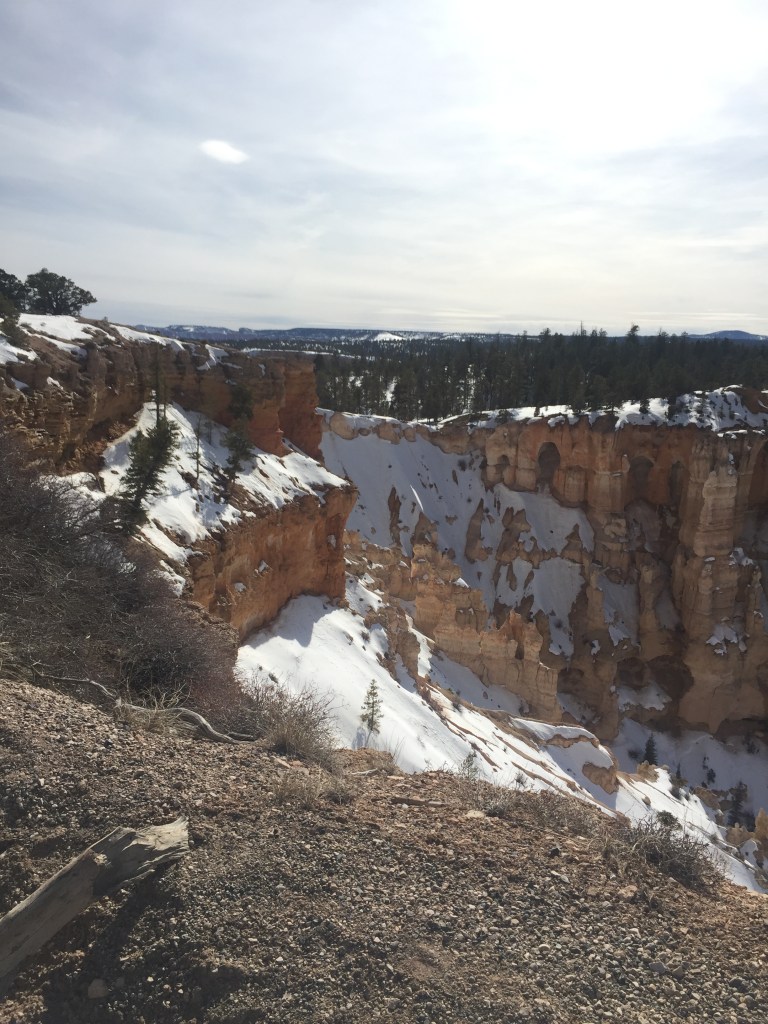
Valley beyond
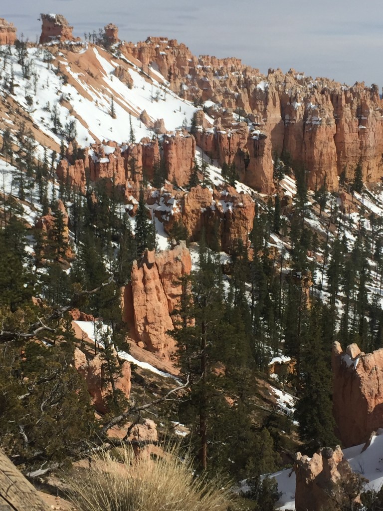
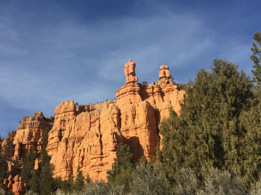
Spires, pines, red rock, snow
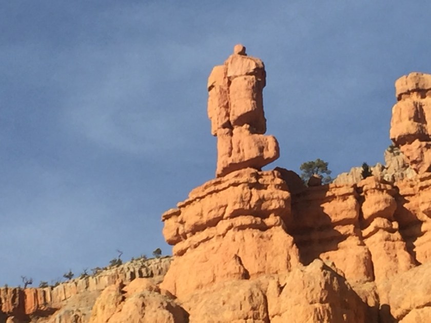
See the hoodoo face on the top right?
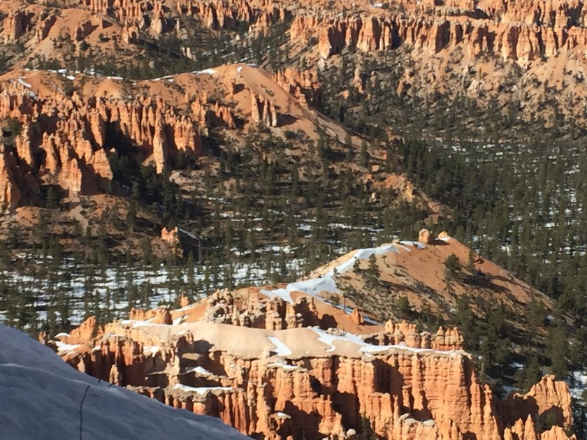
I called these cantaloupe rocks. Sandia Mountain in Albuquerque means watermelon. These are just lovely ripe cantaloupe!
Face on the left
Here’s looking’ at you!
5:45 PM and still almost 2 hours to the motel. Time to get a move on, amazed tourists!
God created such amazing things and we felt privileged to have seen them with our own eyes. What a day!
“We acclaim you, holy Lord, glorious in power. Your mighty works reveal your wisdom and love. You formed us in your own image, giving the whole world into our care, so that, in obedience to you, our Creator, we might rule and serve all your creatures. When our disobedience took us far from you, you did not abandon us to the power of death. In your mercy you came to our help, so that in seeking you we might find you. Again and again you called us into covenant with you, and through the prophets you taught us to hope for salvation.
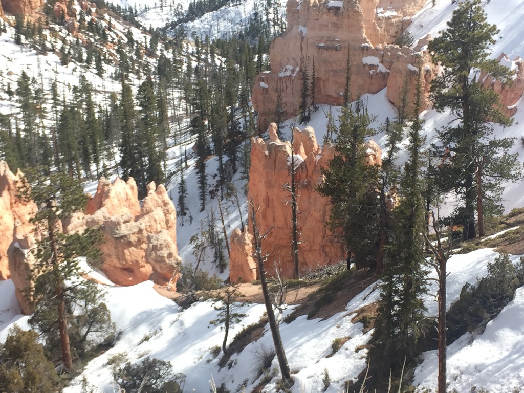
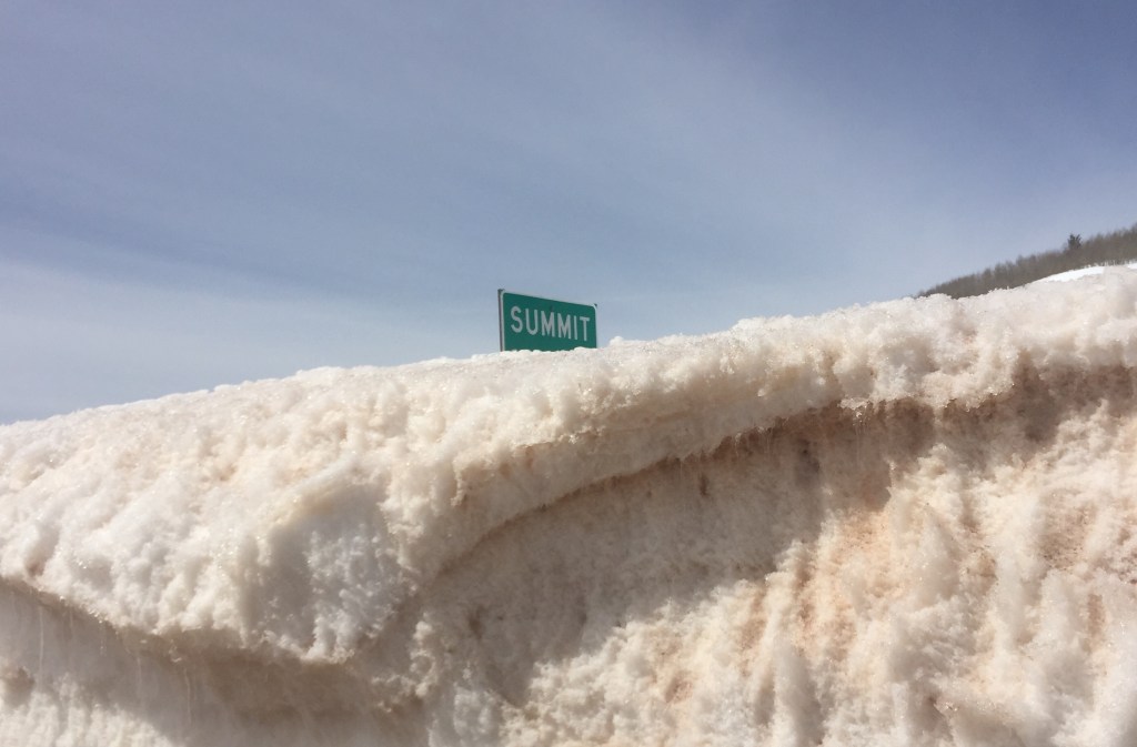
My favorite place on the trip! (The Sandhill Cranes in Nebraska were the most exciting.) We could not travel the entire Park because the road was closed due to excessive snow. National parks evidently are not allowed to salt roads, so any risk of snow melt causing sheets of ice or avalanche danger has the rangers closing that area of the road. I was still delighted with what I did get to see!
The heavens declare the glory of God; the skies proclaim the work of his hands. Day after day they pour forth speech; night after night they reveal knowledge. They have no speech, they use no words; no sound is heard from them. Yet their voice goes out into all the earth, their words to the ends of the world. In the heavens God has pitched a tent for the sun. It is like a bridegroom coming out of his chamber, like a champion rejoicing to run his course. It rises at one end of the heavens and makes its circuit to the other; nothing is deprived of its warmth.
Psalm 19: 1-6 NIV
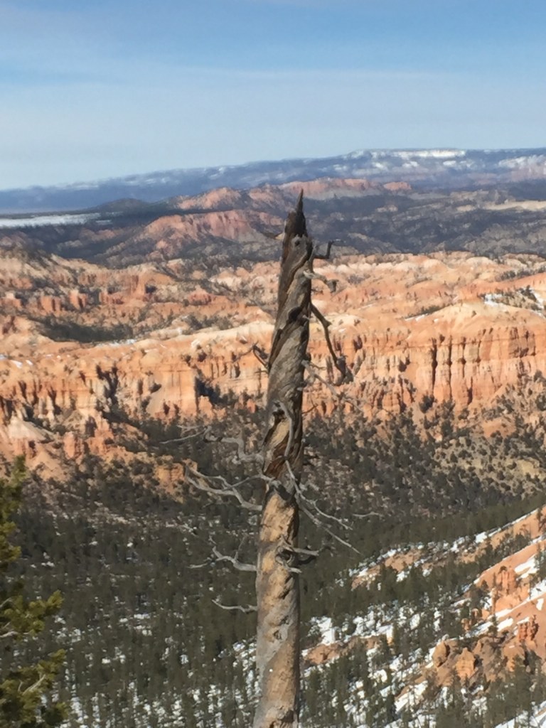
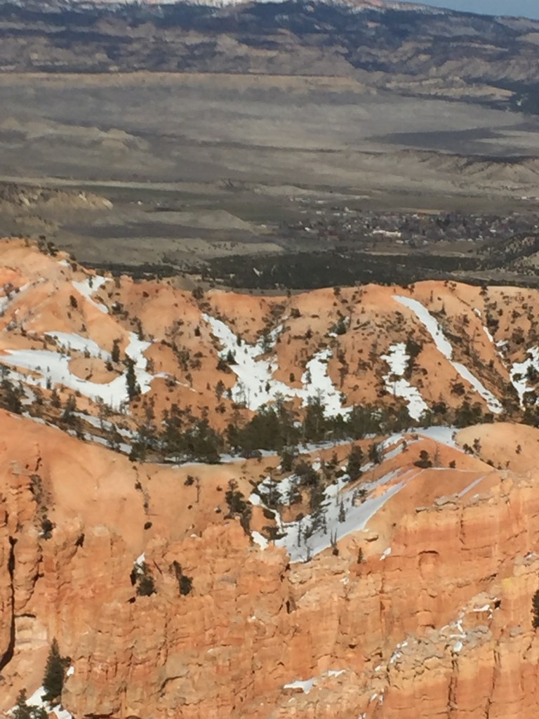
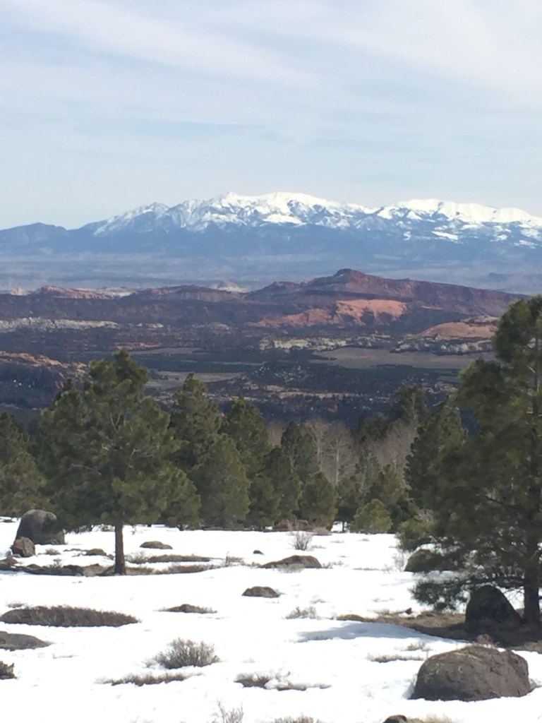
The vast expanse
From The Book of Common Prayer:
“God of all power, Ruler of the Universe, you are worthy of glory and praise. Glory to you for ever and ever.
“At your command all things came to be: the vast expanse of interstellar space, galaxies, suns, the planets in their courses, and this fragile earth, our island home. By your will they were created and have their being. “
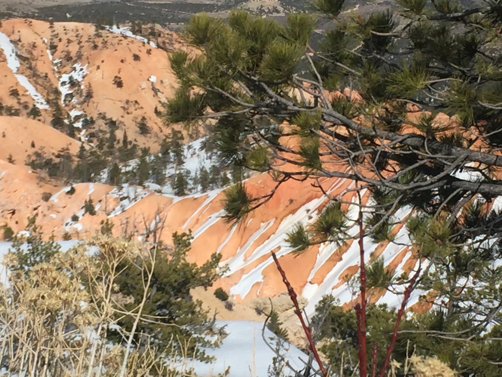
I love the shadows that appear to be undulating when in fact it is the rock face that undulates!
Let those kids get out and run off energy! Let this old woman marvel at the glory of the vista!
Bob liked the hollowed out area in the distance. Not certain how far away it was, but difficult to capture without a telephoto lens!There is a hoodoo!
A what, you say? So glad you ask. Look to the left of the pine tree. There is a rock formation that looks as if it has a black ball on top, shorter than the pine tree. It is bald and wearing sunglasses and a serious expression.
Serious faced hoodoo looking at you!
We have had a few discussions about what constitutes a hoodoo. Here is the Wikipedia version.
“A hoodoo (also called a tent rock, fairy chimney, or earth pyramid) is a tall, thin spire of rock that protrudes from the bottom of an ariddrainage basin or badland. Hoodoos typically consist of relatively soft rock topped by harder, less easily eroded stone that protects each column from the elements. They generally form within sedimentary rock and volcanic rock formations.
“Hoodoos are found mainly in the desert in dry, hot areas. In common usage, the difference between hoodoos and pinnacles (or spires) is that hoodoos have a variable thickness often described as having a “totem pole-shaped body”. A spire, on the other hand, has a smoother profile or uniform thickness that tapers from the ground upward.”
We generally saw hoodoos from below, so this was a treat to see one from above!!
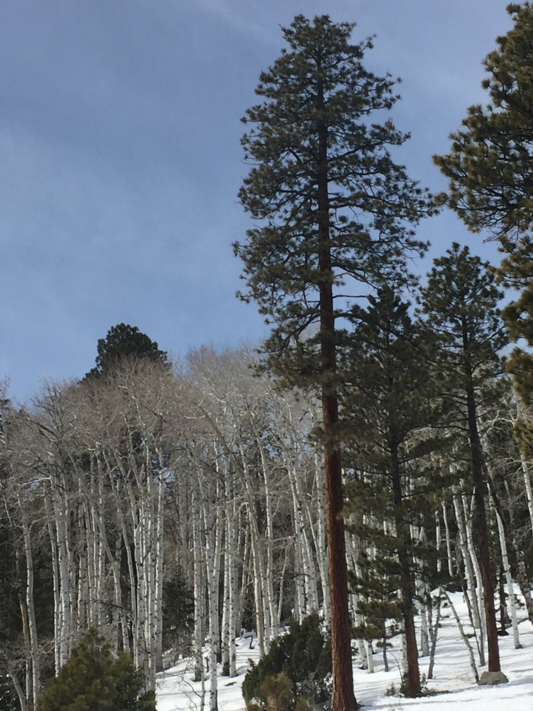
12:22 Same Day! Aspen trees, pines and snow 😉 What’s not to like?!
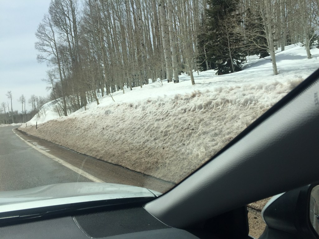
Hard to believe we had left Green River just a few hours ago! Now snow and elevation and more of Utah than I ever knew existed. The aspen were just beginning to turn green with buds. I kept seeing these lovely mountain sides with aspens shadows between the aspen groves. I could never capture them with my camera. Perhaps if we were not just passing through but actually staying a few days I might have gotten the photo my heart wanted. I think we were at about 8,000 feet in elevation?
Weren’t we just amidst colored slabs of rock and sand and oh gosh. Can hardly keep track of the splendor!
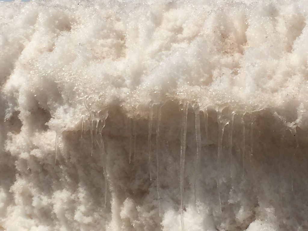
I love icicles that are curved. Exactly how did they get curved?
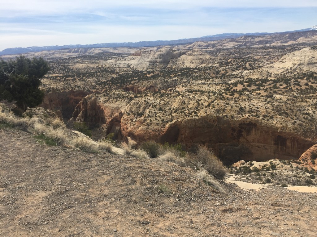
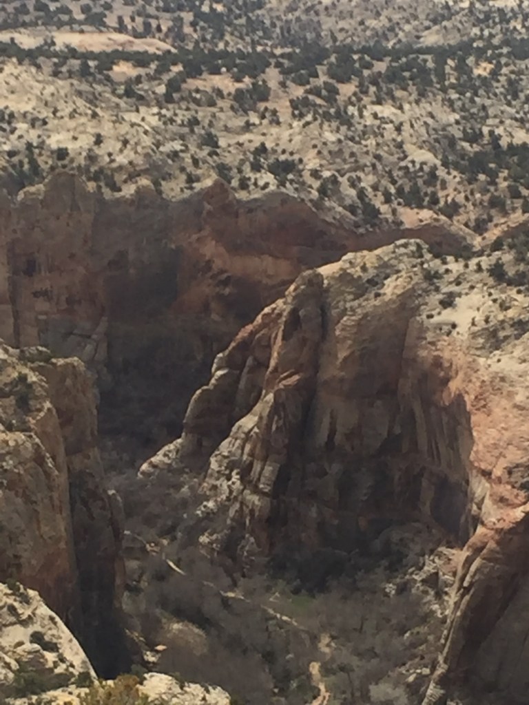
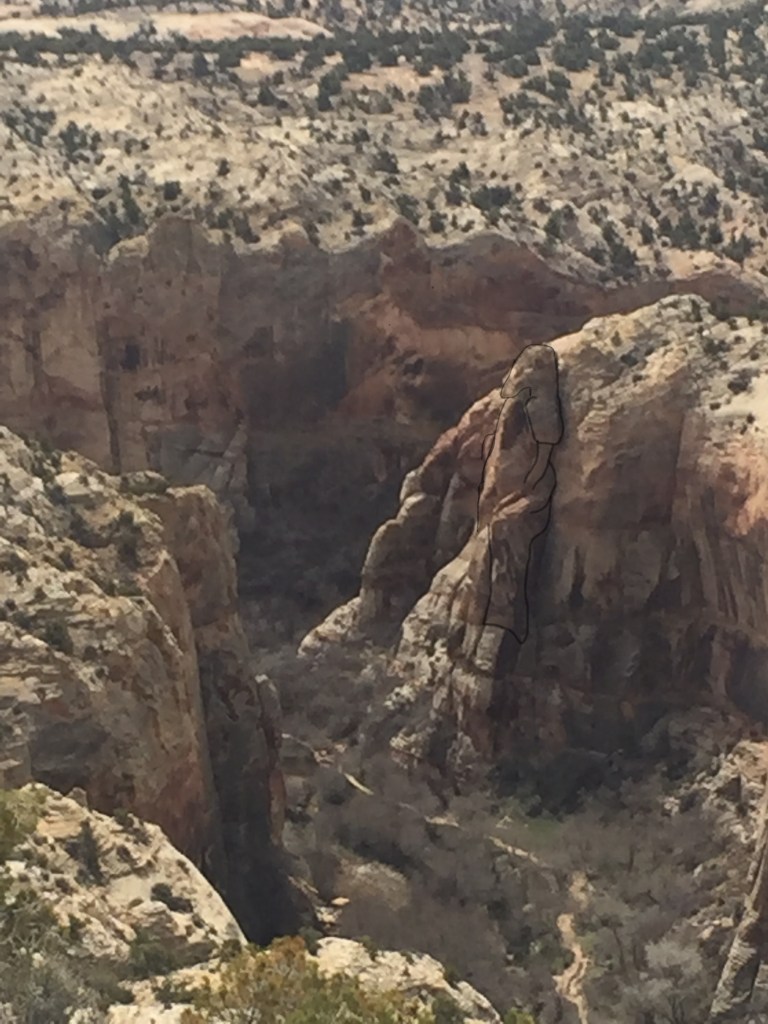
At about 12:45 we were chiding each other that we would never arrive if we kept stopping for photos! There was a family of four traveling just about our speed. Dad kept making them all pose together at lovely photo opportunities. We saw them at the next pull off and Bob decided he would just take a look. He came back to the car to get me. I was not thrilled to walk to the edge of a crevasse to see what had him fascinated. Oh my! I am not a fan of heights, but way below was likely the Escalante River.
No, I do not want to hike down there! Ever.
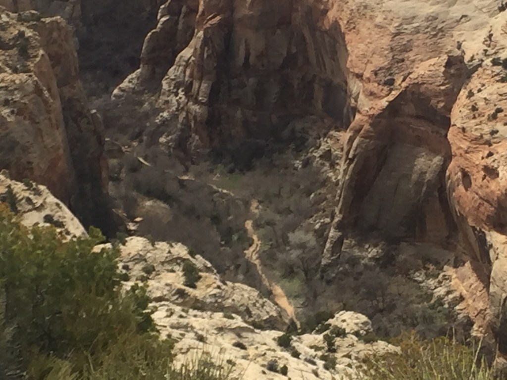
But I did see a hiker resting. A gargantuan hiker that is! If you cannot pick him out in the first photo below, I tried to outline him a bit in the photo the next one.
He even has a sweat stain on the front of his shirt!
Our next stop was Bryce Canyon. After Arches, I kept saying that all I wanted to see was red rocks with snow. I was not disappointed! Since it was one of my most favorite places on our journey I think I will devote tomorrow to just photos of Bryce. (By the way we made it to Cedar City, just barely before dark. Sadly, there was no elevator and they put us on the second floor! Getting too old to haul stuff up the stairs like that. Decided next time we would ask for a different room or help getting luggage in and out of the room.)
We awoke tired from our extra-long day, but happy from our travels. Seems we had landed in another era. The motel hallways the night before were full of what seemed like sister-wives, girls who looked like teenagers in long dresses of various colors roaming the halls with younger children, doing laundry, in and out of rooms together. We honestly could not tell who was in charge of them. If they were one family or married into one family. And more strange, the next morning it was as if they had never been there. Not a one showed at breakfast. Yes, we were in Utah, but all those kids? It seemed as if they would have fed them before departing? Do not think it was a residential situation as they were doing things like purchasing laundry soap at the front desk the night before. Just weird.
There are animals in the US that never appear when the daytime traveler is driving: elk, moose, big horn sheep, mountain goats, cougar or mountain cats. We saw the warning signs and never saw the animals!
This was Day Ten of our travels.We were almost on stimulation overload from the scenery changes. Little did we know there were more dramatic changes before us. I had absolutely no idea how beautiful Utah was! I had only been to the Salt Lake area airport and north areas. Most of the comments below are from Bob, photos are from Molly.
“Quoting from my husband’s travel journal: “This was another day of endless surprises and unexpected panoramas. I did not anticipate the majestic beauty before us. And I had no idea that there would be so much snow. It was a beautiful and nealy cloudless day as wdrove from Green River. We were to drive the scenic route from there to Cedar City via routes 24, 12, 89, and 14. It was an all-day drive of some 320 miles.
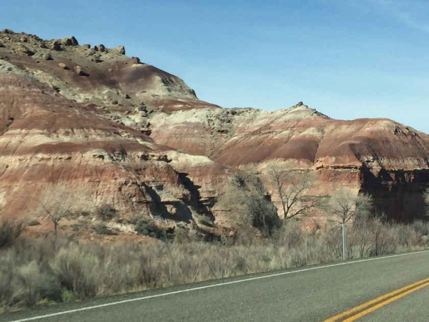
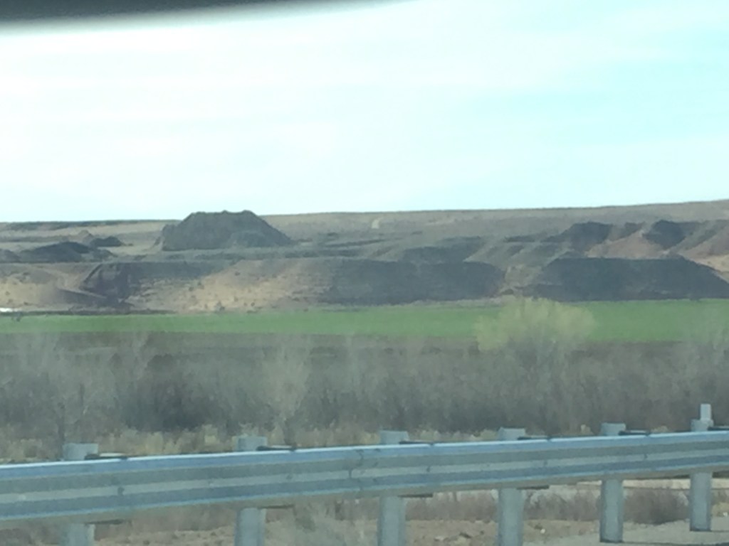
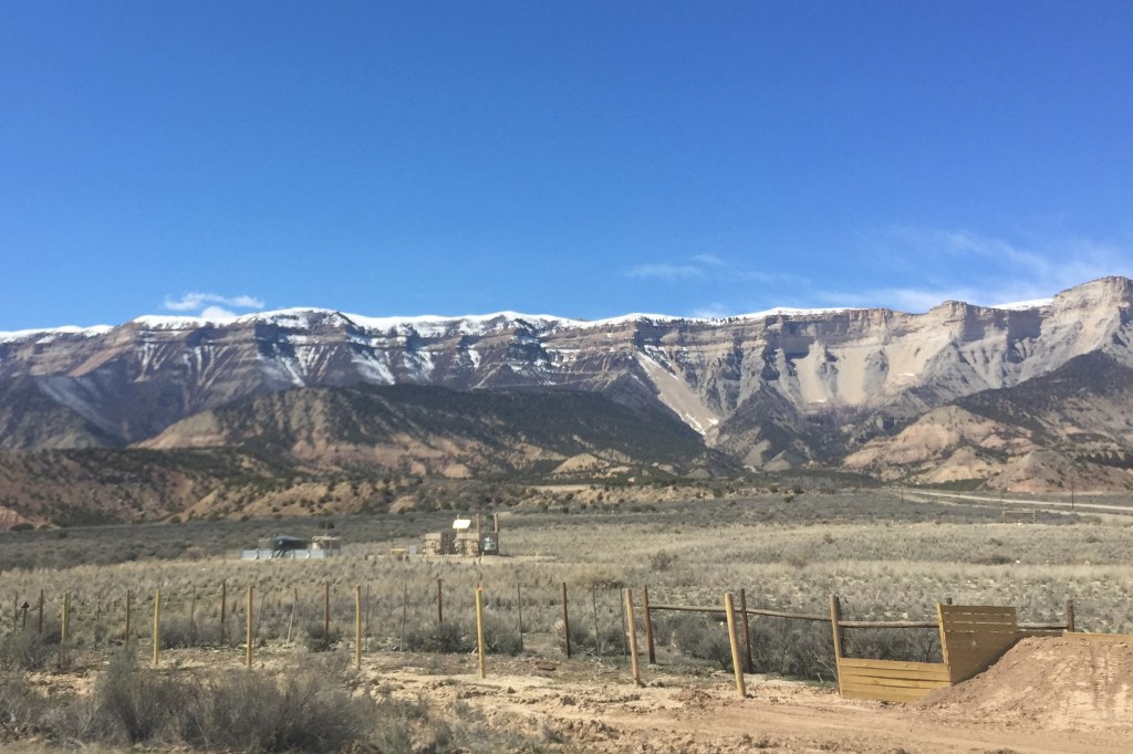
Barren scrub and striated rocks at one glance and then (below)Turn your head and an irrigated area pops up all lush and green. And then the fights over access to water become clear again!
Quoting Bob again: “We started with typical high desert. Sage and sand and range land with grazing cattle. Very few other cars, few houses, fewer towns, the occasional butte or other sandstone formation that was seemingly dropped in its current location. These alien structures became more numerous and more varied in shape and color. It was like Legoland met the Mad Potter! Sometimes it seemed as if a draftsman had designed perfectly straight lines and other times it was a modern abstractionist messing with my mind.
“The colors changed with some regularity: reds and yellows, blacks and grays, white Navajo sandstone and a whole crayon box full of other colors. Some were pure, others striated.”
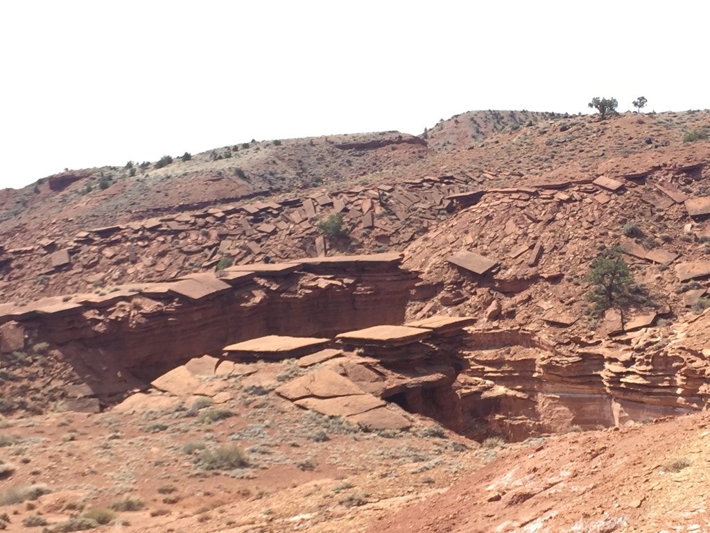
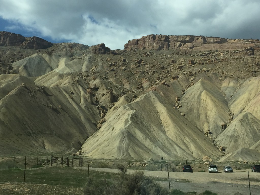
“The Capitol Reef area is where it began to get bizzare; tall thin tablets, honeycombed faces, piles of perfectly symmetrical slabs of stone, smooth faced cliffs and groves of pillars. Some of the formations were hundreds of feet tall; others simple hoodoos. There were even petroglyphs.”
Molly: I have friends who had recently put down a new floor for an Aunt in Washington State. It took them several weeks to accomplish. When I saw the photo below I thought of them with piles and piles of flooring to be installed!
Flooring? And it was only 11:30 in the morning!
Bob was really good about watching how much time we spent in amazement in each area. This was all before noon
We were going to drive to Grand Junction, but Bob decided we were too early to check in to a hotel, so we drove on the Arches National Park and then to Green River. What a long, exciting day.
10:58 AM which will matter as the day unfolds.
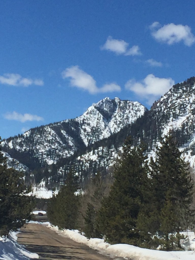
The drive from Fort Collins goes down towards Denver, then across the Rockies via I-70. This follows Glenwood canyon along the Colorado river. The mountain pass at Vail is 10,603 feet. We saw things that were too far to photograph and new to us. Like not just exits for skiing areas, but actual snowboard courses with people flying down them. Have seen that on TV, but cannot imagine actually DOING snowboarding, or skiing for that matter. I have never been known for my coordination or sports prowess. Ramps and ski jumps and things that amazed me, people willingly riding lifts to the top. I am also not a fan of heights, so there is that wonderment, too!
We saw signs for Aspen, Beaver Creek, Vail, Copper Mountain, Breckenridge, Arapahoe, and Keystone, all famous ski areas that we had never visited, but often heard about on news and sports channels.
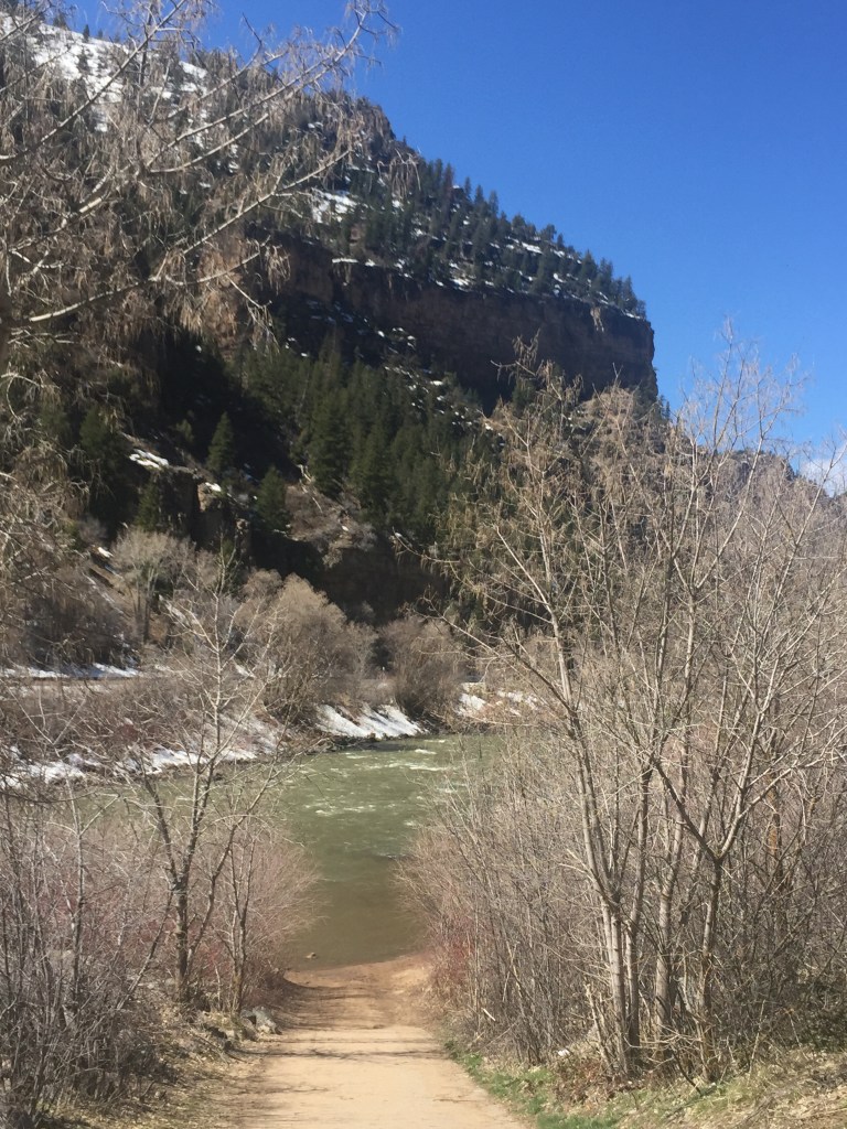
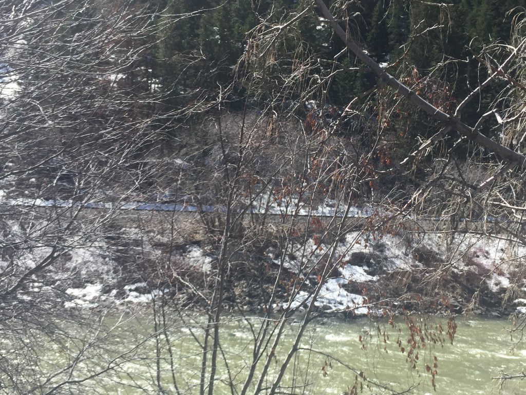
Years ago we took our children to the west coast from Ohio on the Amtrak. The train followed parts of this same road. We were delighted to see the tracks and confirm our memories!
Colorado River 12:25See the tracks on far side of river!
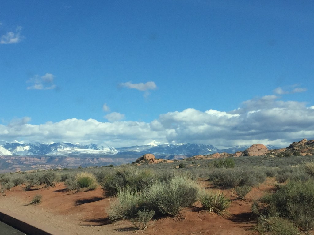
And such terrain change in one day! Huge mountain peaks, national forests, the glory of the mountains with snow, without snow, river canyon, tunnels, scenic overlooks and then on towards the Colorado plateau of eastern Utah with dry, rocky terrain anywhere from 4,500 to 6,500 feet in elevation at Arches.
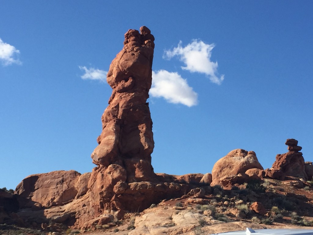
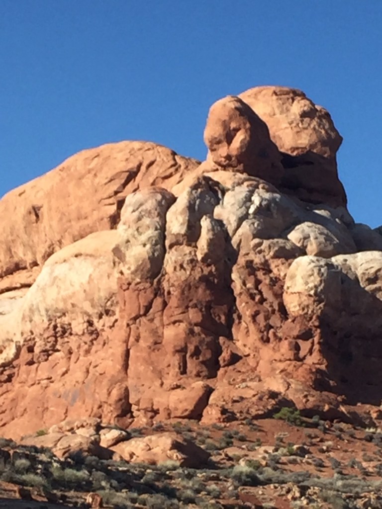
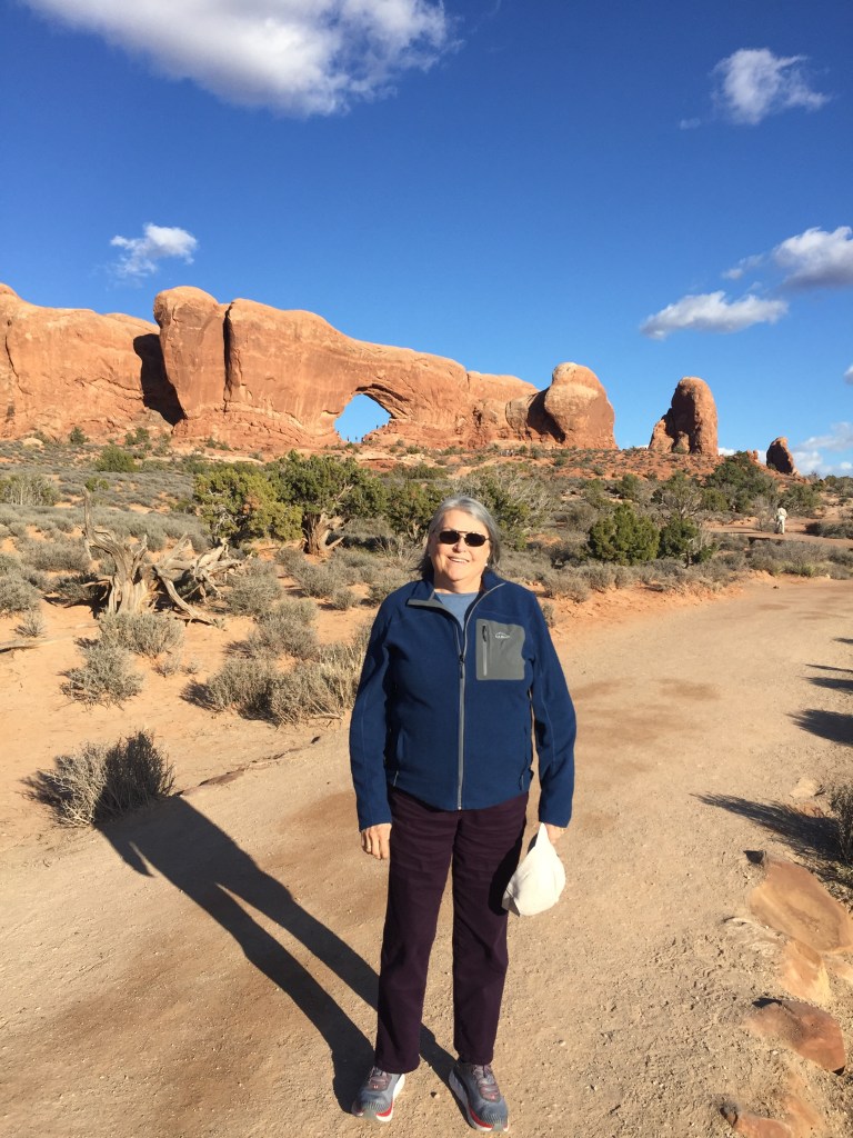
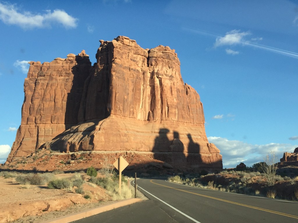
Two hours later, 2:35, still Colorado!Gives an entire new meaning to get out and stretch your legs! People walking along the lower edge, up the path with shadows, and on the ridge if you can see them! 3:11 PM5:21 PM Long but amazing day! Now in Utah for certain.5:30 Arches National ParkIs it a Sphynx or a dog?
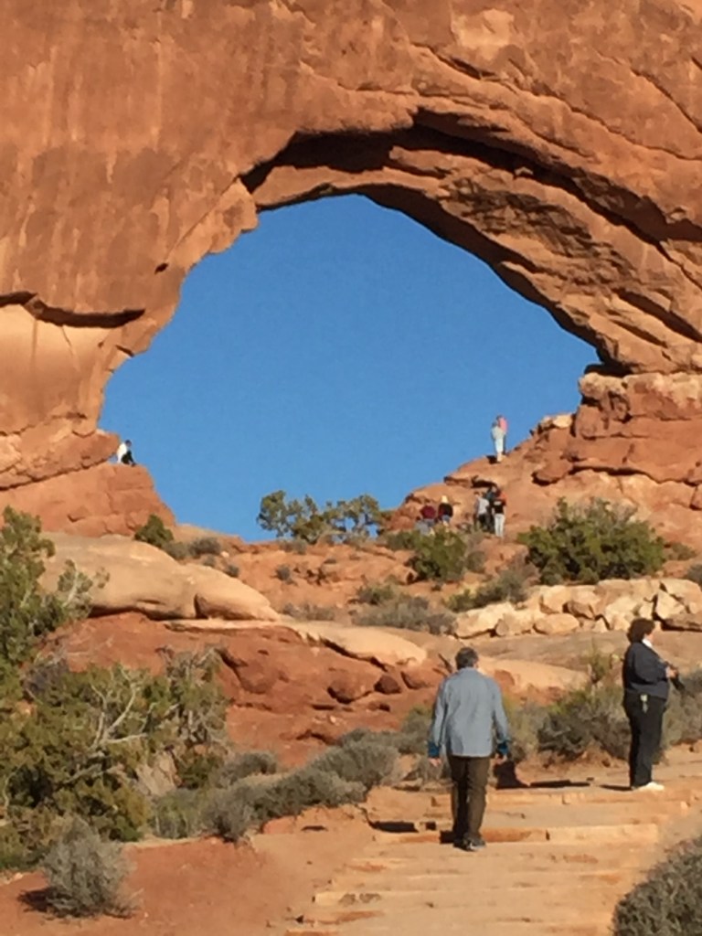
Bob had to climb alone as the day was wearing me thin energy-wise. He made it into the big arch.
Take nothing but photos, leave nothing but footprints! 6:14 PMI appreciated the Three Wise Men (shadows) on our way out of the park at 6:40 PM
On our way to our hotel we agreed there were almost more landscape/environmental changes in one day than we could comprehend. Sort of sightseeing whiplash 😉
We also agreed the next day NOT to make such a long day again on this month-long journey.
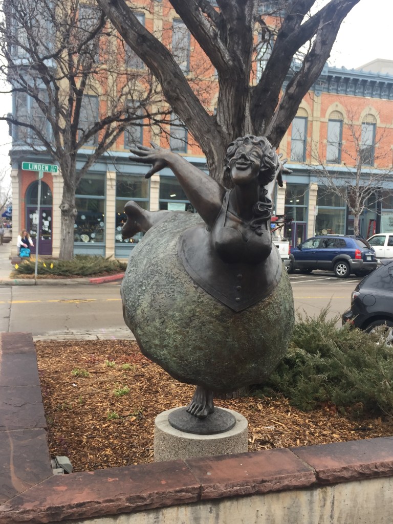
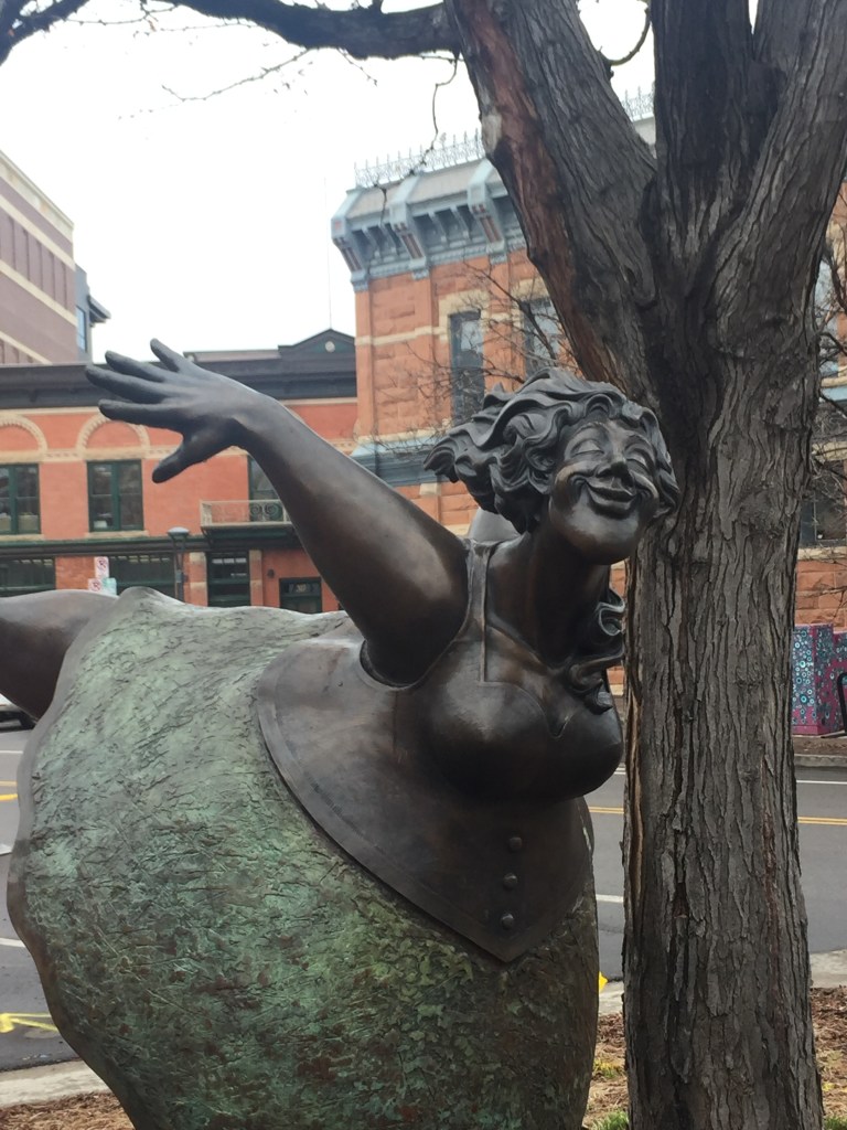
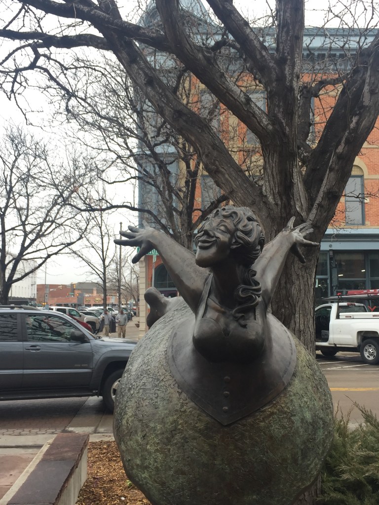
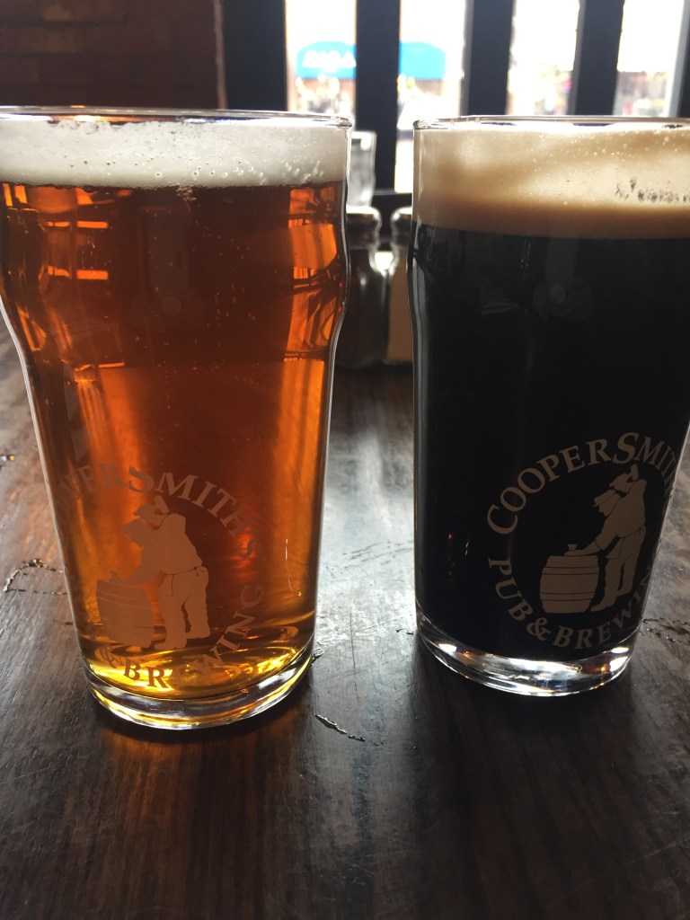
Fort Collins has a neat district called Old Town. Found these two sculptures there that made me laugh out loud. So descriptive of some of my friends and I. Instead of making lemonade, “You Might As Well Dance!”
Only wish I had taken a photo from the other side where her petticoats showed! ;-D
And if in Old Town for lunch you might as well have a cold one, too! Mine was the stout, in more ways than one!